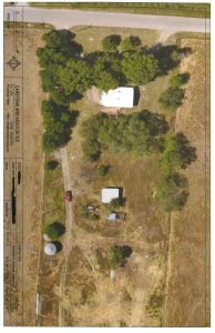
 Drone imagery is use used in almost every project in our office. It provides accurate information as to what the property looks like to date, contours, distances for setbacks, and locations of wells, drain fields, and septic lids. Using our drone image, you can see exactly where your property boundary lies, instead of relying on often inaccurate pubic access mapping.